Through this swim around the Isle of Arran, I’m raising funds for the vital marine conservation work of Community of Arran Seabed Trust (COAST). You can donate via this JustGiving page here.
For my other daily blog posts, please click here.
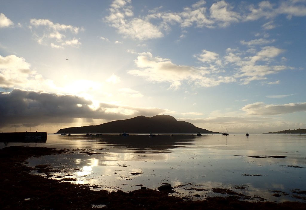
Picking my way over the weed-dressed stones at Lamlash I felt a knot at the top of my stomach. I have done at least one big sea swim each summer over the past few years. But this is the first year in seven I’ve tried circling an island through a series of long swims and I’m nervous about how it will go.
I think I’ve done the training I need and, barring some aches and stiff joints here and there, it has gone well. I finished my preparations with a 10km swim in the pool just over a week ago and that was promisingly uneventful (and mind-bendingly dull). But what I don’t know is how my 51-year-old body is going to cope with the cumulative impact of perhaps nine of those in succession.
One big source of reassurance is the presence of my kayaker friend Steve, who accompanied me around the Isle of Man seven years ago. He has kayaked three times around Arran already, once to accompany Isle of Man-based swimmer Carole Laporte.
Everything feels better in the sea which, for me, lifts the mind as well as the body. After a couple of minutes of tentative breaststroke and fiddling with a splendid new pair of goggles that sadly don’t fit my face, I started to front crawl out into Lamlash Bay. Enclosed in the sombre turquoise, I started to feel sealed off, for now, from my self-doubt.
Lamlash looks onto a broad and deep crescent-shaped bay and beyond it, the Scottish mainland. On a map the bay resembles jaws closing around Holy Isle, which rises out of the sea as a steep and rugged hill around a mile offshore.
Offering a deep, natural harbour, facing away from the prevailing winds and enclosed by the Firth of Clyde, Lamlash has hosted naval fleets across the centuries. In 1263, King Hakon of Norway anchored his fleet here during an ill-fated attempt to reassert Norwegian control over the western isles of Scotland.
Historian Thorbjorn Campbell, in his Arran – A History, refers to English fleets mooring at Arran during the Tudor period and describes how:
“Before the First World War, Winston Churchill, First Lord of the Admiralty, ordered the fleet to Lamlash in 1914 in order to threaten Belfast when Ulster seemed likely to rebel against the Liberal Government’s intention to grant Home Rule to Ireland.”
During the First World War, German submarines laid mines in the waters between Arran and the mainland.
Aside from these intermittent visits by naval vessels, much of the marine traffic in the Bay over the epochs has been fishing vessels. Lamlash was recognised for its abundant fish stocks as far back as the late Seventeenth Century. Traveller and writer Martin Martin, in his “Circa 1695” book, A Description of the Western Islands of Scotland, notes the “great fishing of cod and whiting in [and] about this bay.”
Fishing in the area declined from the mid-1980s, however. Scientists from the University of York have blamed this on “poor fishery management decisions”, notably the removal of restrictions on trawling in the Clyde estuary from 1962 onwards.
The demise of fish stocks round Arran forms the background to the extraordinary story of the Community of Arran Seabed Trust (COAST), the charity for which I am raising funds through this swim, and the marine reserve off Lamlash.
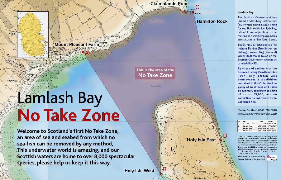
Local divers Howard Wood and Don MacNeish witnessed the collapse, in Lamlash Bay, of a once abundant and diverse fish population. In 1995 they began efforts to protect the bay from unsustainable inshore fisheries, notably dredging and bottom trawling. Drawing on increasing local support, their 13-year campaign finally persuaded the government to introduce in law a No Take Zone on 20th September 2008.
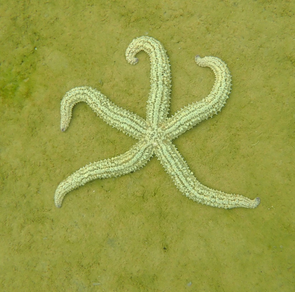
The No Take Zone is 2.67 square kilometres and is the first community-led marine reserve of its kind in Scotland. No fish or shellfish can be taken from its waters or seabed, including the shore area. The Zone protects one of the largest maerl beds in Scotland. Maerl is a type of coralline pink seaweed that forms a complex maze across the seabed that is ideal for small species to find food and hide from predators.
Lamlash No Take Zone also has patches of seagrass beds, kelp forests and spectacular boulders covered with beautiful sea life. You can get a flavour of this through COAST’s film The Bay. COAST also have an interactive dive map which shows images and videos of what divers find under the waves.
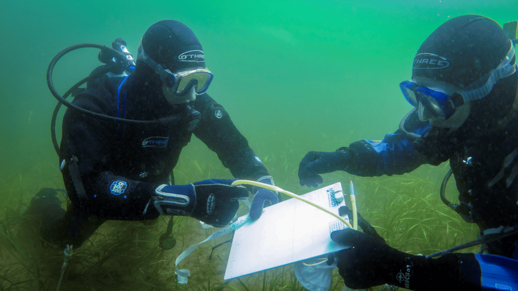
In the years since the establishment of the No Take Zone, Lamlash Bay has been the focus of a series of scientific surveys to gauge its impact.
The findings are striking. A 2020 study by scientists from the University of York showed that:
- Numbers of some species have increased by nearly four-fold since the project started.
- There are nearly four times more king scallops in the area since 2010, the size of adult scallops has increased and there are more juvenile scallops present in the area. Lobsters are also shown to be benefiting, with growing numbers of larger lobsters and evidence of lobster ‘spillover’ into surrounding areas.
- The seabed is recovering after damage caused by fishing with trawls and dredges, with the growth of structurally complex ‘nursery habitats’ which provide refuge for marine life.
The University of York study argues that, of even greater importance, is the influence the Lamlash Bay project and COAST have had on marine protection nationally and internationally. The findings are acting as a blueprint to support similar areas and other coastal communities around Scotland and further afield, and underline the case for increased marine protection.
While I’m no expert on marine conservation, this last point about the catalytic effect of COAST’s work and the Lamlash Bay No Take Zone rings some bells. My previous island swim, in 2019, was around the Isle of Man which began introducing marine protected areas in 2011 – three years after the advent of the Lamlash No Take Zone – after a collapse in scallop populations due to excessive dredging.
The story of the rapid, positive impact of introducing marine reserves in the Isle of Man seems to me quite comparable to the experience in Arran. Anyone interested should buy the lyrical Spring Tides by Manx conservationist, poet and author Fiona Gell, who has played a leading role in marine protection in the Isle of Man.
Around a mile out from my starting point, I stopped to ask Steve where was the boundary the No Take Zone. “The gannets know,” he said. Ahead of us a pair of the birds wheeled and dived, creating crowns of spray as they hit the surface and then the fish below.
The wind picked up. A southerly, it propelled Steve’s kayak forward, while I toiled, as small racing waves flooded my shoulders each time I lifted them above the surface.
Reaching the edge of the bay, we passed through a narrow channel between Clauchlands Point and a tiny islet called Hamilton Isle, presumably named after the Dukes of Hamilton, Arran’s former overlords. Hamilton Isle has since been claimed by flocks of shags and a seal. I’m afraid we disturbed the birds, although it looks like they settled again almost as soon as our invasion was over.
Beyond the point we headed northwest and traced the rocks toward Brodick. I sighted on the alpine vista of Goatfell, Arran’s highest mountain. Rising to 874 metres, it sits across the Highland Boundary Fault, which is where geological formations associated with the Scottish Highlands meet the rocks of the lowlands.
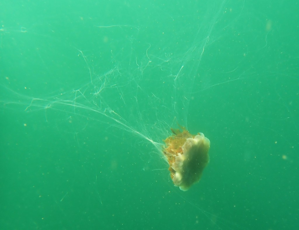
Below me I counted my fifth Lion’s Mane jellyfish of the day. All of them, thankfully, had stationed themselves about 1.5 metres below the surface. One of them had its tentacles splayed, but the others were a safe distance below me.
A couple of kilometres from Brodick, I stopped to face the face that was staring back a few metres in front of me. “I’ve been trying to tell you – that seal has been tailing you for about half an hour now,” said Steve. “I was worried it might nibble your toes.”
Like most people who enjoy sea swimming around the British Isles, I’ve had to learn a bit about seals and their sometimes tactile overtures. Off the coast of the Isle of Man, I’ve had seals hugging me with their flippers and gripping my feet in their mouths.
With all this mind, I brought with me, to Arran, a favourite book called Seal Secrets, by Sue Sayer, anticipating I might need to consult it on questions of seal behaviour. Sue has previously given me some very handy tips on etiquette. “Pushing, nudging and vocalisations may be signs that the seal would prefer to be left alone. Swatting their fore flipper towards you means go away in seal language.”
Here my shadow swam a couple of metres beneath me, performing the occasional corkscrew to reveal a cream speckled belly. This was a grey seal; one of two seal species found on Arran (the other being the common or harbour seal). Judging by the size it was probably an adolescent. It kept its polite distance (so much that you can barely make out a silhouette in the video clip below) and I enjoyed the company. As we approached Brodick even I could feel the vibrations of the approaching passenger ferry propellers piling into my ears, and the seal faded off into the blue.
By the time we got to the jetty at Brodick, I was cold. That was largely down to my time-outs to gaze at seals, seabirds, and jellyfish, but thought-provoking all the same. It had taken 3 hours 40 minutes to cover 9.2km (5.7 miles).
The next swim, on Sunday afternoon, starts where this one finished and I’ll be heading on northwards in the direction of Corrie.


Leave a Reply